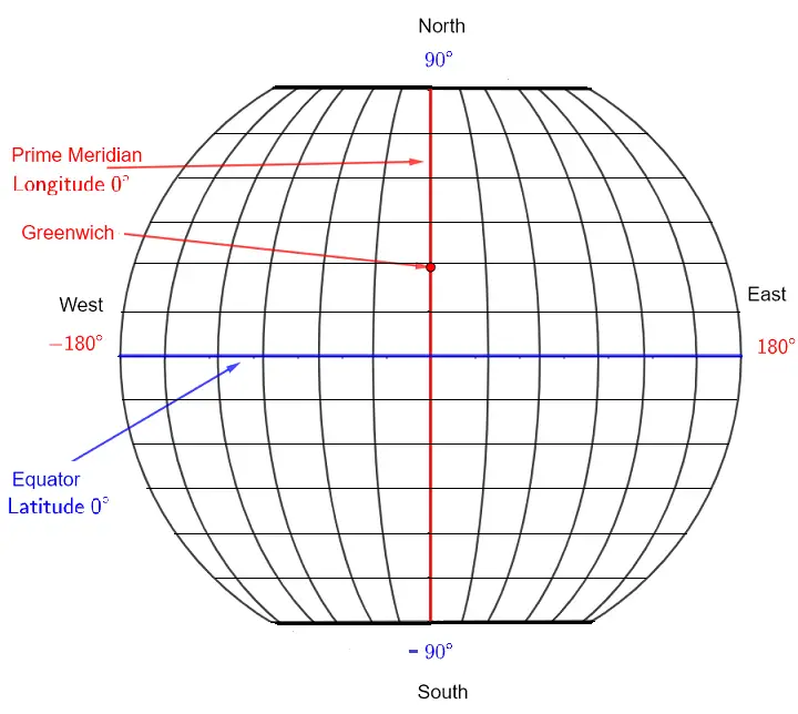
The Prime Meridian and the Equator
It is internationally agreed that the prime meridian is an imaginary great circle that divides the Earth (supposed to be a sphere) into two hemispheres—the eastern and western parts—as shown in Figures 1 and 2 below. The prime meridian circle runs through Greenwich, England.
The equator is also an imaginary circle that is equidistant from the North and South poles and divides the Earth into two hemispheres: the northern and southern parts.

The latitude is an angular measurement between the plane of the equator and the radius from the center of the Earth to the location considered. Therefore, locations on Earth with the same latitude form a circle called a line of latitude (see Figure 2).
The longitude is an angular measurement of the angle between the plane containing the prime meridian and the plane containing the North and South poles and the location considered. Points with the same longitude form a circle called a line of longitude or meridian.

View Example 1: Coordinates of Points A, B, C, and D
Example 1: Write the latitude and longitude of points A, B, C, and D (in Figure 2) using North (N), South (S), East (E), and West (W).
- Point A is at the intersection of the line with latitude \(30^\circ\) North and longitude \(60^\circ\) East. Written as: \(30^\circ\text{ N}, 60^\circ\text{ E}\)
- Point B is at latitude \(45^\circ\) N and longitude \(15^\circ\) W. Written as: \(45^\circ\text{ N}, 15^\circ\text{ W}\)
- Point C is at latitude \(15^\circ\) S and longitude \(75^\circ\) W. Written as: \(15^\circ\text{ S}, 75^\circ\text{ W}\)
- Point D is at latitude \(45^\circ\) S and longitude \(30^\circ\) E. Written as: \(45^\circ\text{ S}, 30^\circ\text{ E}\)